
 Home
HomeBy Caitlin E. Devor
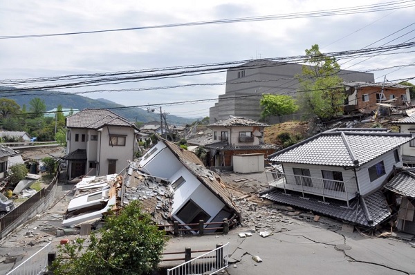
Mashiki is a small town in southwestern Japan, Kumamoto Prefecture, which was near the epicenter of two major earthquakes on Thursday, April 14, 2016 and on Saturday, April 16, 2016.
Hiroshima University researchers Hideaki Goto, PhD, and Yasuhiro Kumahara, PhD, specialize in geomorphology – studying the shape of Earth’s surface. They arrived in Kumamoto on Friday to collect data after Thursday evening’s earthquake. They were shaken awake at about 1:30am on Saturday by the second, larger earthquake in Mashiki. These photos from Saturday afternoon in Mashiki show some of the damage that local residents experienced.
Two types of responsibility are predictors of OCD or GAD
(Credit: Emma Buchet and Associate Professor Yoshinori Sugiura/Hiroshima University)
The damage in Mashiki after Saturday’s earthquake was unexpected because the town is about 2km (1.6miles) away from Futagawa Fault. Associate Professors Hideaki Goto and Yasuhiro Kumahara followed the trail of disrupted earth branching off from Futagawa Fault all the way into the center of Mashiki. This trail of surface ruptures may trace a newly identified branch of Futagawa Fault. Professor Emeritus Takashi Nakata led a separate team to map surface ruptures along the known portion of Futagawa Fault, first identified over 30 years ago.
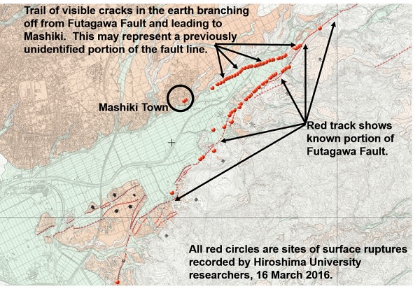
Photo Credit: Yasuhiro Kumahara, Hiroshima University.
Goto and Kumahara followed the trail of surface ruptures into Mashiki. Buildings and homes closest to the surface ruptures experienced the most severe shaking and many had collapsed.
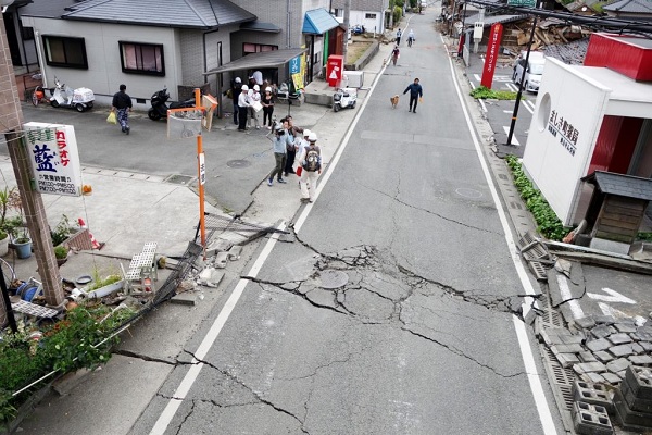
The break in the white paint lines on either side of the road reveals the severity of the side-to-side shift in the earth. Photo Credit: Yasuhiro Kumahara, Hiroshima University.
Associate Professors Hideaki Goto and Yasuhiro Kumahara spent one day mapping the surface ruptures, but plan to return again in the coming weeks for additional field work.
“We want to do end-to-end mapping of the surface ruptures so that we can identify any branches of Futagawa Fault revealed by these recent earthquakes,” Goto said.
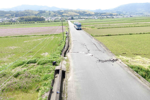
Photo Credit: Yasuhiro Kumahara, Hiroshima University.
“Personally, the experience is devastating. But academically, there is much to discover,” Kumahara said.
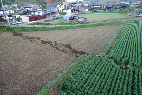
This image is one of the new surface ruptures northeast of Mashiki in an area with many farms. About seven rows of crops are misaligned in this field, revealing a dramatic side-to-side shift in the earth. Photo Credit: Yasuhiro Kumahara, Hiroshima University.
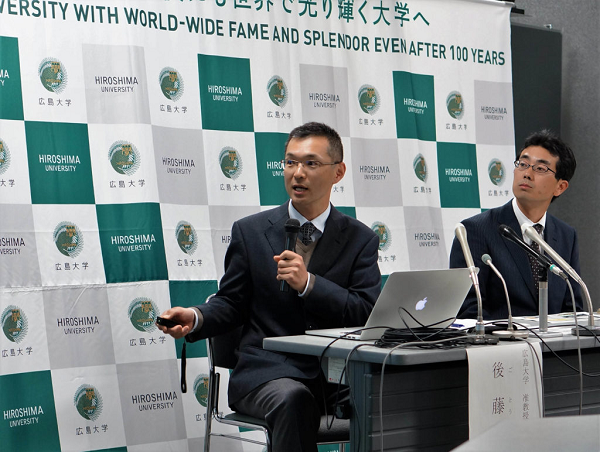
Goto (left) and Kumahara (right) spoke to the media on Monday. Photo Credit: Public Relations Group, Hiroshima University
For the latest news on all Hiroshima University activities, like our Facebook page at www.facebook.com/HiroshimaUniversityResearch.